Trail of the Week: Lost Lake Trail
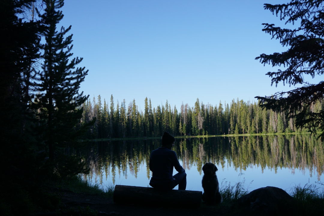
Morning at Lost Lake.
Image: Kirsten Dobroth
You may have seen signage for Lost Lake and its associated roads and trailheads while making the pilgrimage to Piney. Although the neighbor of one of Vail's most photographed lake is certainly smaller and a bit more out of the way, it's still a breathtaking destination that lacks the crowds drawn to Piney's banks. A subtle elevation gain also makes this another great hike for trail runners, and a nice option for out-of-towners looking to get in some mileage without the lung-and-leg-taxing vert. Mountain biking is also allowed, and with its S-shaped flat sections and mellow steeps, if you're not already a mountain biker this trail might just make you want to try it.
The Route
You have two options: From the eastern trailhead (off of Forest Road #786), the trail stumbles upon the lake in about a half a mile. But, that's no fun — the trek from the western trailhead (off of Forest Road #700) winds through pine and aspen groves for 3.4 miles before it ends at the banks of Lost Lake (well, technically, it continues to the eastern trailhead, but after spotting the reflective waters, you'll probably agree that it's a great turnaround point). The first section of trail grants big views to the south — Vail Mountain, Beaver Creek, and Holy Cross are all within view — along with expansive Gore Range views from virtually every section of trail. The trail gradually climbs, although the steepest section is found just before the descent to the lake, a reward that more than makes up for the effort.
Quick Facts
- Trailhead: Lost Lake West Trailhead
- Starting Elevation: 9,657 feet
- Highest Elevation: 10,294 feet
- Roundtrip Distance: 6.8 miles
- USFS recreation sheet with map
- Season: Summer, fall
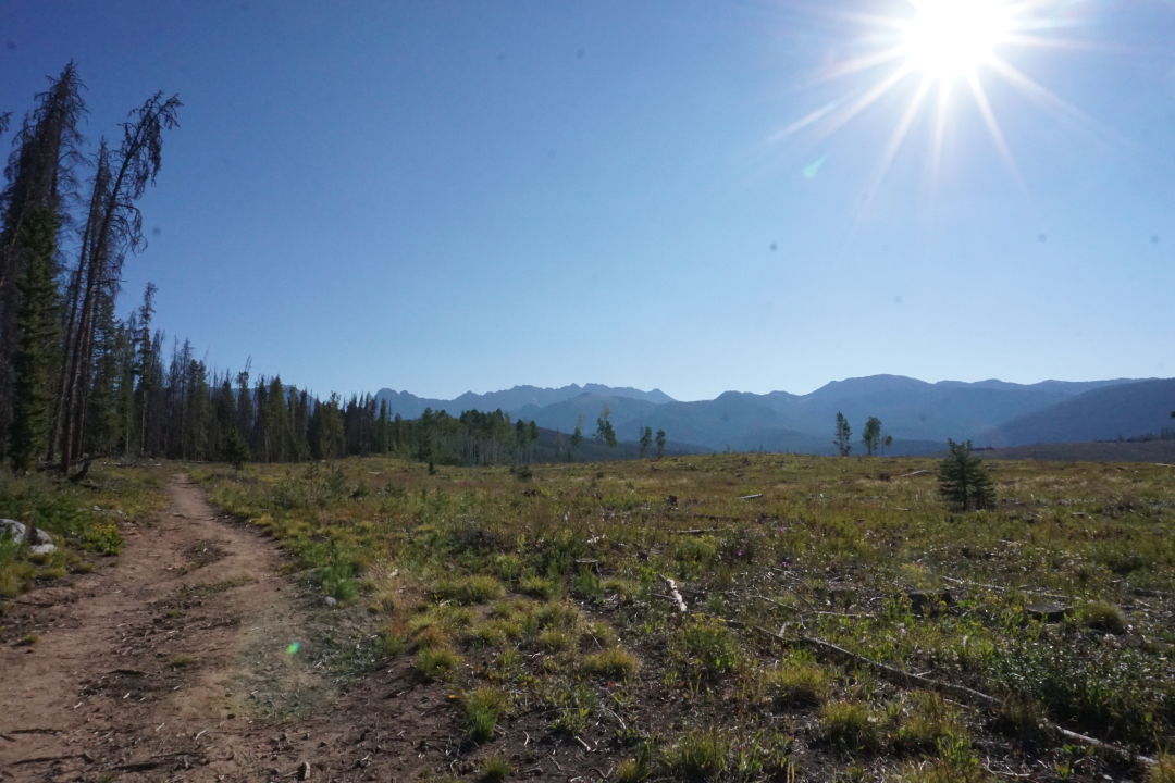
Views from the trail's first mile.
Image: Kirsten Dobroth
Trailhead
From I-70, take Vail Exit 176 and turn north onto North Frontage Road before driving west, then take a right (turning north) onto Red Sandstone Road. Follow Red Sandstone as it turns into a dirt road (Red Sandstone Road #700), and continue for 6 miles to the trailhead, following signage for Piney Lake (you will also see signage for Lost Lake, but this is for the eastern trailhead). Ignore any forks and continue straight. The trailhead is on your right.
Dogs
Your pup will love the shady aspen and pine groves on this trail, and the subtle elevation gain, which make this a great out and back for pooches (and their humans) looking to get in some decent mileage without exhausting vertical. Mountain bikers use this trail, too, so make sure Fido is under control and out of the way for cyclists.
Backpack Must-Haves
- Water
- Sunscreen
- A headlamp (if leaving the trailhead before sunrise, or late in the afternoon)
- Layers (weather can blow in quickly, a water-resistant layer is a must)
- Snacks
Additional Considerations
There are campsites scattered around Lost Lake, but keep in mind that US Forest Service rules prohibit camping within 200 feet of the lake and trail, so even if that lakeside spot looks too-good-to-be-true, back it up until you find a site that meets the guidelines. If you do camp, follow standard pack-it-in, pack-it-out protocol so that others can enjoy Lost Lake — without seeing any evidence that you were there first.