Trail of the Week: The Davos Trail
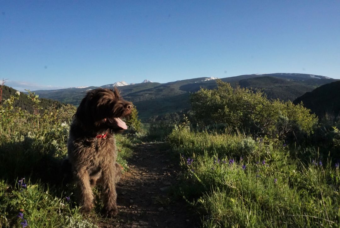
Vailmag.com mascot Yukon Cornelius, and one of the many views of Mount of the Holy Cross.
Image: Kirsten Dobroth
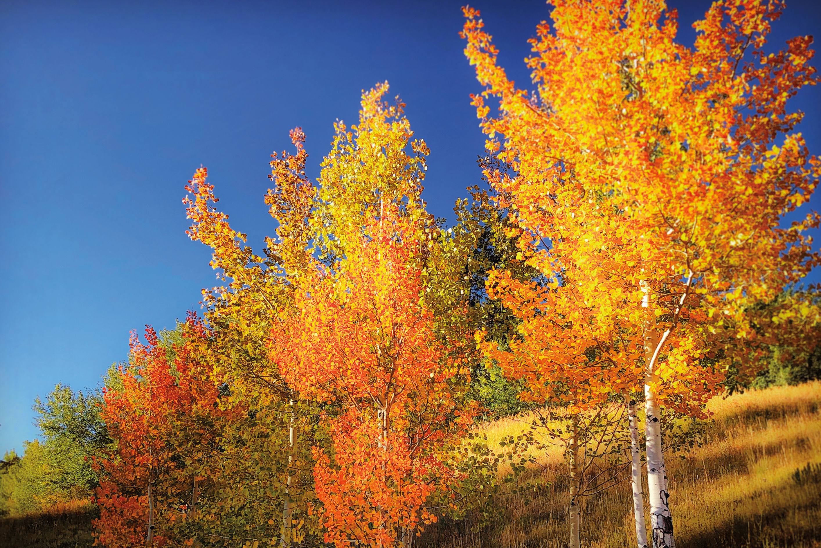
If you live in West Vail, you've probably hiked, biked, or snowshoed the Davos Trail at some point. While you may know it well, your dog probably knows it better than you, and you know all the places he or she likes to sniff — and the spots he or she likes to sniff just a little too much. If you've never hiked Davos, you're in for an approachable 6-mile roundtrip out and back hike that offers glimpses of Minturn, Mount of the Holy Cross, Notch Mountain, Meadow Mountain, Gilman, and Beaver Creek, all via an old Jeep road, which makes conquering this classic a feasible bucket list item for out-of-towners, or as a less strenuous way to add some mileage to your week.
The Route
The Davos Trail intersects Vail's valley-spanning North Trail, atop Cortina Lane at the end of West Vail's neighborhoods on the north side of the highway. Hikers can use it as a jumping on point for the North Trail, or bike or hike the trail in its entirety, as it dead ends near a radio tower overlooking I-70 and Eagle-Vail to the west. Because it's a former 4x4 trail, it's ideal for runners, bikers, groups, inexperienced hikers, snowshoers, and a favorite for dog-walkers. Almost immediately, trail users will see prominent signage and a turnoff for the North Trail on the right as it continues towards Buffehr Creek, although hikers should keep heading straight to continue on Davos. Shortly thereafter, another section of the North Trail joins up with Davos, although this is a steep, short section, and trail users should keep following the 4x4 road. There's one last split in the trail about a mile later (a remnant of the old four-wheel drive network), and hikers should continue past it as they follow Davos. As the trail winds along the hillsides above Dowd Junction, hikers meander through aspen groves and rolling meadows with prominent views of Meadow Mountain, Mount of the Holy Cross, and Notch Mountain to the south.
Quick Facts
- Trailhead: The Davos Trail, at the end of Cortina Lane
- Starting Elevation: 8,252 feet
- Highest Elevation: 8,929 feet
- Roundtrip Distance: 5.8 miles
- USFS recreation sheet with map
- Season: Year round
Trailhead
Take Exit 173 (West Vail) from I-70, and head north from the highway, exiting the roundabout to the right at the sign for Chamonix Road. Follow Chamonix Road as it veers left at a "T" in the road before taking a subsequent right onto Arosa Drive. Pass Ellefson Park on your right, before taking the next right onto Cortina Lane, where it switchbacks and concludes at the trailhead.
Dogs
Dogs are frequent and welcome travelers on Davos Trail, but keep in mind that the trail is highly trafficked, so if your pup doesn't like to play nice with the pack, you should probably leave him at home. Pick up and carry out any animal waste and bring plenty of extra water for your pooch — Davos is dry and hot in the summer.
Backpack Must-Haves
- Water
- Sunscreen
- A brimmed-hat (Davos is often sunny and hot, especially in the middle of the day)
- A headlamp (if leaving the trailhead before sunrise, or late in the afternoon)
- Layers (weather can blow in quickly, a water-resistant layer is a must)
- Snacks
Additional Considerations
Keep in mind that this trail is frequently used for various forms of travel — hiking, running, biking — and users should always be conscious of those traveling around them. Davos is a great place to enter or exit the North Trail. More information: see the US Forest Service's recreation sheet.